Artificial Intelligence-driven landslide alert system tested in seismically vulnerable Nepal
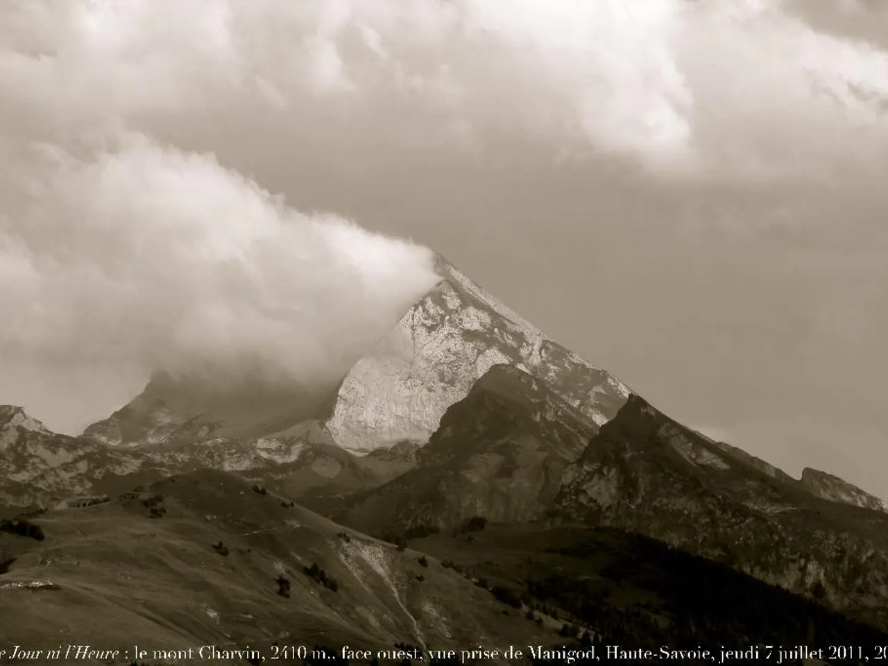
In the high-risk landslide areas of Kimtang (Nuwakot district) and Jyotinagar (Dhading district) in Nepal, an innovative AI-powered early warning system is being piloted. Developed by Australian professor Antoinette Tordesillas and partners, this system, named SAFE-RISCCS, aims to revolutionise landslide prediction and mitigation efforts in these vulnerable regions.
The system, currently in a preliminary testing phase, integrates local community knowledge with technical data analysis to create an accessible and resource-efficient warning platform. It compares data from local technical advisers like Sanjaya Devkota with a threshold that might indicate a landslide.
The AI component of the system automatically generates a graphical view and alerts the experts based on the rainfall forecast. However, with only two months of data collected so far, its effectiveness is yet to be fully established. A longer dataset, ideally spanning one to two years, is needed for the AI to reliably generate forecasts and alerts.
Every year during the monsoon season, floods and landslides wreak havoc across South Asia, claiming hundreds of lives. While two-thirds of the region have early warning systems for disasters in place, many other vulnerable countries have little coverage. Nepal, with its unstable geology, shifting rainfall patterns, and poorly planned development, is especially vulnerable.
Landslides are frequent in Tamang's village in Kimtang and many villages in Nepal. Tamang, a local resident, contributes to the system by sending photos of water levels to experts in Kathmandu. She knows the risks firsthand, as she and her family had to relocate due to soil erosion when she was five years old.
Last year, landslides killed more than 300 people and were responsible for 70% of monsoon-linked deaths, according to government data. Such technologies are considered necessary for Nepal to reduce its monsoon toll.
The landslide forecasting platform, SAFE-RISCCS, is a low-cost but high-impact solution. It is designed to be resource-efficient and build on the community's deep local knowledge and active involvement. If the system performs well during the ongoing monsoon season, it will be a strong tool for landslide prediction in these vulnerable areas.
Similar systems are already in use in several other countries, including the United States and China. The project is cautiously optimistic that if the system performs well during the ongoing monsoon season despite Nepal's complex Himalayan terrain, it will be a significant step forward in tackling landslide prediction challenges in Nepal.
The landslide monitoring system is being piloted in two high-risk areas: Kimtang in Nuwakot district and Jyotinagar in Dhading district. The system eventually aims to deliver a continuously updated landslide risk map to aid decision-makers and local communities in taking preventive measures and evacuation decisions. Asia suffered more climate and weather-related hazards than any other region in 2023, with floods and storms the most deadly and costly. The development of this system is a testament to the ongoing efforts to improve disaster preparedness and resilience in the region.
- The SAFE-RISCCS landslide forecasting platform, currently in a testing phase, combines science, environmental-science, and data-and-cloud-computing to revolutionize landslide prediction and mitigation efforts in high-risk areas like Kimtang and Jyotinagar in Nepal.
- To ensure the system's effectiveness, a longer dataset, ideally spanning one to two years, is required for the AI component to reliably generate forecasts and alerts, contributing significantly to climate-change studies and disaster management.
- With the integration of local community knowledge, such as from residents like Tamang in Kimtang, and technology, SAFE-RISCCS is a promising solution for tackling climate change-related challenges, particularly landslide prediction in Nepal and similar regions across the globe.


